highest quality at a competitive price
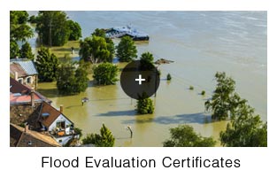
A flood elevation certificate is a standard form developed by FEMA and the National Flood Insurance Program (NFIP). The purpose of this form is to standardize and determine insurance rates in a flood zone.
A flood certificate determines what flood zone applies to your home or business. A surveyor will determine the exact elevation of your lowest finished floor and/or basement and garage (if applicable). Using fema's base flood elevation for your area, insurance companies can determine the risk of the dwelling. This can be essential for determining the cost of flood insurance from insurance brokers.
Many existing homes in NJ are in flood zones and are not covered by their basic home or business insurance policies. Most insurance policies do not cover flooding from storms. Flood damage must be covered under a separate policy even if you live outside of a flood zone. A surveyor of the state of new jersey is the only professional that can determine a flood elevation in our state.
Click here to view samples on the FEMA website »
Union Affiliated
Accepts Major Credit Cards