highest quality at a competitive price
By definition, a land survey is a report in the form of a map showing the location of a parcel of real property. A land survey should be performed whenever there are boundary changes or land division, ownership transfer, when erecting fences or structures related to a property boundary.
Landmark's registered land surveyors will help find your existing property corners and advise title insurance companies, attorneys or lenders needed to obtain title or mortgage insurance accordingly. We will establish new markers and monuments for missing property corners and locate buildings, fences encroachments and other improvements.

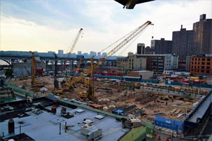
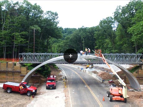
Coordination is key throughout all phases of construction. We cooperate and work closely with builders, road developers, utility companies and all state and local agencies to ensure the highest level of accuracy. From grading stakes and footings for road and bridge development; to layout for curb and centerline for roadway construction; to as-built steel and concrete girders for pan and final deck grades. Landmark's highly skilled Team Surveyors are your partners throughout each project.
A survey shall show the property lines and or boundary lines on a map prepared by a licensed surveyor. The survey shall show bearing distances and area from previously recorded deeds from the county seat. The map will also include all physical structures ie. House, shed garages pools and fences. Your property can be subject to easement for telephone, storm, sewer conservation and other types of utilities.
A Boundary Survey is a procedure completed to decide property lines and characterize genuine property corners of an area of land depicted in a deed. It also demonstrates the degree of any easements or infringements, or encroachments, and may demonstrate the constraints forced on the property by state or neighborhood controls. Easements, while not limited to, may incorporate a utility line easement crossing the subject property to a neighboring property or appurtenant like the privilege to cross another property for access to an open street. Then again, the utilization of a real estate parcel by an individual other than the proprietor unaccompanied by a specialist to do as such is usually referred to as infringement.
Boundary surveys are an imperative system for anybody purchasing a property of any kind, and are normally performed before purchasing, subdividing, enhancing or expanding. Surveying the area before these tasks guarantees shirking of future debate, the cost and frustration of protecting a claim or lawsuit, moving a building, or settling a boundary issue. The total cost of any boundary survey will differ depending on many factors, some factors will often be known only after work has already commenced. Some variables such as terrain, location, season, and plant growth will also affect the overall cost.


Union Affiliated
Accepts Major Credit Cards